파일:Blank France map, no Departments.svg

SVG 파일의 PNG 형식의 미리보기 크기: 507 × 520 픽셀. 다른 해상도: 234 × 240 픽셀 | 468 × 480 픽셀 | 749 × 768 픽셀 | 998 × 1,024 픽셀 | 1,997 × 2,048 픽셀
원본 파일 (SVG 파일, 실제 크기 507 × 520 픽셀, 파일 크기: 16 KB)
Clickable version
| 설명 |
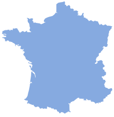
English: Map showing France without departemental borders. |
||||
| 날짜 | 2007년 7월 5일 (upload date) | ||||
| 출처 |
|
||||
| 저자 | Lokal_Profil | ||||
| 저작권 (이 파일을 인용하기) |
Original image licensed under
|
파일 역사
날짜/시간 링크를 클릭하면 해당 시간의 파일을 볼 수 있습니다.
| 날짜/시간 | 섬네일 | 크기 | 사용자 | 설명 | |
|---|---|---|---|---|---|
| 현재 | 2007년 7월 6일 (금) 01:24 | | 507 × 520 (16 KB) | Lokal Profil | {{Information |Description={{en|Map showing France without departemental borders.}} |Source=*Vector map from Image:Départements de France-simple.svg by SuperManu. *Modified by Lokal_Profil |Date=05-07 |
이 파일을 사용하는 문서
이 파일을 사용하는 문서가 없습니다.
이 파일을 사용하고 있는 모든 위키의 문서 목록
다음 위키에서 이 파일을 사용하고 있습니다:
- cs.wiktionary.org에서 이 파일을 사용하고 있는 문서 목록
- de.wikipedia.org에서 이 파일을 사용하고 있는 문서 목록
- fr.wikipedia.org에서 이 파일을 사용하고 있는 문서 목록
- Géographie de la Bourgogne
- Champagne humide
- Lomagne
- Catégorie:Wikipédia:ébauche géographie de la France
- Côte-sous-le-vent
- Côte-au-vent
- Canal de Craponne
- Massif ardennais
- Côte atlantique française
- Grand Ouest français
- Plateau de Vassieux
- Côtes de Moselle
- Pas de l'Escalette
- Tunnel du Pas de l'Escalette
- Blayais
- Tunnel de la Vierge
- Wikipédia:Liste de bandeaux d'ébauches de géographie/France
- Frontière entre l'Australie et la France
- Frontière entre la France et Maurice
- Frontière entre la France et Madagascar
- Frontière entre la France et les Seychelles
- Frontière entre la France et les Îles Salomon
- Frontière entre la France et le Vanuatu
- Frontière entre la France et les Kiribati
- Frontière entre la France et les Samoa
- Cubzaguais
- Grand Est français
- Zone d'activité économique
- Bassin de vie
- La Caume
- Arc atlantique
- Utilisateur:The Obento Musubi/Userbox/Français
- Pays Coupés
- Bassin de la Seine
- Frontières du Nord-Pas-de-Calais
- Bassin versant de la Dordogne
- Cap d'Estaing
- Col de la Croix de Mounis
- Canal de la vallée des Baux
- Frontière entre la France et le Mozambique
- Salins de Frontignan
- Lido de Thau
- Mondial de l'automobile de Paris 2018
- Orxois
- Modèle:Première française
- Modèle:Première française/Documentation
- Gorges de la Vingeanne
- hr.wiktionary.org에서 이 파일을 사용하고 있는 문서 목록